
GENEROUS CURVES
We are at the centre of the Mediterranean along the routes from the Suez Canal to Gibraltar, in a strategic position for traffic between East and West.
Among the most important ports in Italy for cargo handling, the port is located in the Gulf of Taranto, in the Mar Grande and immediately outside it.
IN THE MEDITERRANEAN
A port divided into different sectors: the commercial port, the industrial port and the tourist port. If the new city is situated on the mainland, the old one is on a small island with two seas around it: to the south-west, the Mar Grande bordered by the Chéradi islands, and to the north-east, the Mar Piccolo.
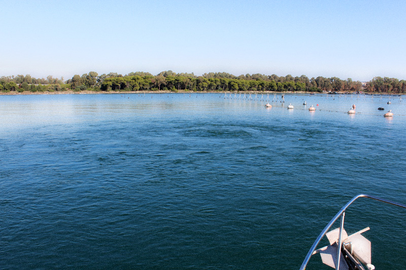
The latter, with a surface area of 20 square kilometres and a depth of about 14 metres, has underwater freshwater springs and three water courses: the Galeso, Cervaro and Rasca.
Taranto and its geography
The Taranto area lies on the Ionian Sea, on that coastline that geomorphologists call the Taranto Ionic Arch. It is the largest gulf in Italy, widening into a flat landscape.
On the coast to the west we find an extensive area with shoals and rocky outcrops, while to the east there is the wide expanse of the ‘Mar Grande’, which embraces the entire stretch from Punta Rondinella to Capo S. Vito. The southern side of the Gulf of Taranto is made up of the Ionian coasts of Calabria, to the north-west lies Basilicata, while the Apulian territory with the Salento peninsula stretches to the east.
WINDS, TIDES AND CURRENTS
The winds and tides, but also the underwater (freshwater) springs, influence the surface and deep currents in the two seas of Taranto and have played an important role for those who have sailed in these waters.
The strongest and most frequent winds are the Tramontana (from the north) and the Mistral (from the northwest), but the Libeccio (from the southwest) and those from the eastern (east and southeast) and southern sectors also arrive in Taranto.
The tides (both astronomical and those due to wind and atmospheric pressure) and tidal currents are modest: the sea level varies by about 10 to 20 cm.
Currents in the gulf, caused by differences in the density of the water, usually do not exceed 1 knot in speed and are parallel to the coast.
IT'S MADE LIKE THIS
Puglia is the Italian region where soluble rocks, i.e. limestone that can dissolve in weakly acidic waters, appear most often.
But it is also the 'least Italian' of the regions due to the simplicity of its geological history.
GEOLOGICAL EVOLUTION
The geological history of Apulia and the Taranto area is linked to the evolution of the southern Apennines, which has depended in turn on the formation and expansion of the Mediterranean Sea.
Inland from Taranto and the Mar Piccolo we encounter a series of marine terraces that show us how much the topographical surface has risen over time and allow us to see in sequence the rocks that have stratified over the last 2.5 million years (Quaternary).
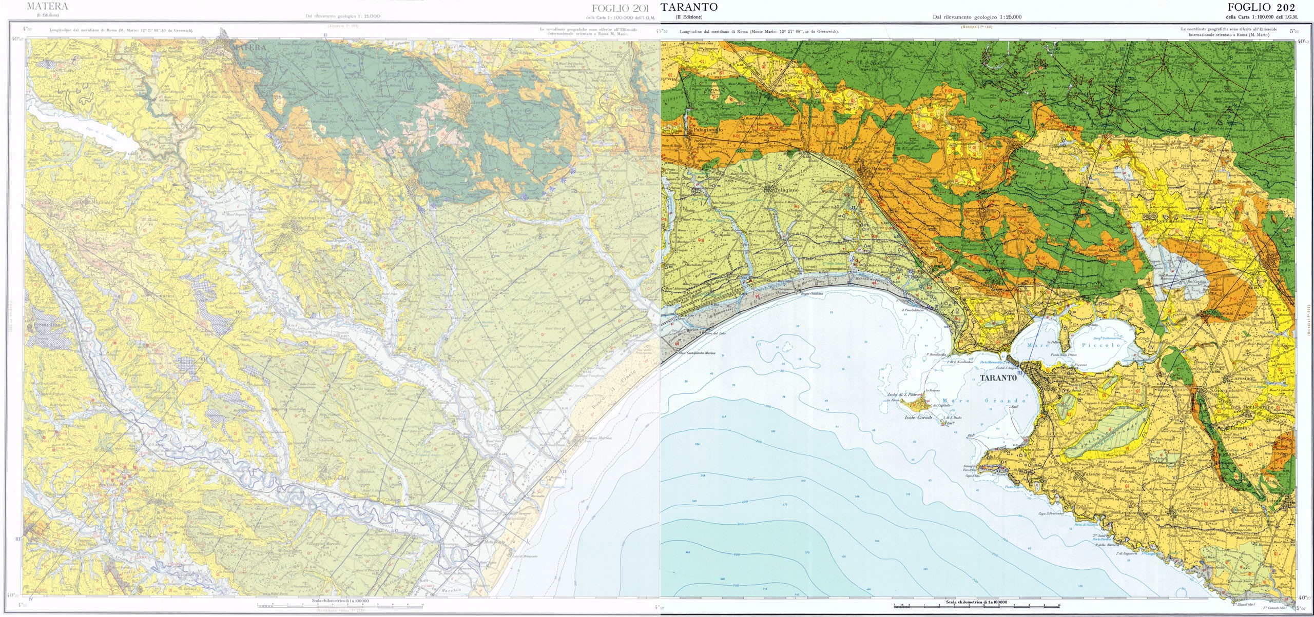
geological map of Taranto taken from: www.isprambiente.gov.it
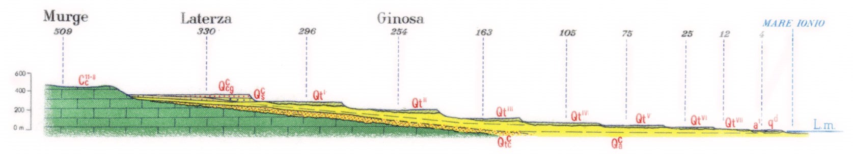
geological profile taken from: www.isprambiente.gov.it
The “Citri”